Tuesday, September 21, 2010

Wedding in Mississippi


John and I left Montana on September 16, and flew to Memphis where we rented a car and drove to West Point, Mississippi where John's cousin Ann grew up. We left our coach in the KOA RV park in Billings and left early in the am on a flight for Memphis, TN. The temperature when we left Montana was in the 50's. When we stepped off the plane in Memphis we were greeted with temperatures in the 90's. I think that John was ready to get back on the plane and head back to Montana!!!!

John was to give the Bride away! I must say that he looked pretty dapper in his tux! The Bride was beautiful! and all went well. We had a wonderful time and met some very nice people. One couple was from Argentina and the other from Chicago. We had such a nice time with them!

We left Mississippi and flew back to Montana on Monday, September 20. We picked up our coach and headed to Buffalo, Wyoming for a few days before heading to Rapid City for the Retired Pilots Convention.

We had a great time at the convention!!! It is always such fun to see old friends and share stories of days gone by. It is such a shame that the airline business will never be the same!!!!

From Rapid City we are off to the Twin Cities in Minnesota to see the Grandchildren and spend a few days before heading out to Washington, DC.

More on our adventures later. Until then, I hope that now that summer is almost at its close everyone is well and enjoying the fall weather!

Love to all,

Candy and John

Posted by Picasa

Wednesday, September 15, 2010

Little Bighorn Battlefield 2010/09/13


The day dawned a sunny bright warm day and once again we headed out to see the local sights! We headed east out of Billings and about 60 miles down Interstate -90 we turned into the Little Bighorn Battlefield National Monument, Montana.
Our first stop was in the visitor center. An announcement was made that in a few minutes there would be a Ranger Talk on the plaza just outside the building. The Ranger told the story of the Battle of Little Bighorn. He was a fantastic story teller! He really made the story come to life.

The battle of Little Bighorn was a clash of cultures!!
Little Bighorn Battlefield National Monument memorializes one of the last armed efforts of the Northern Plains Indians to preserve their ancestral way of life. Here in the valley of the Little Bighorn River on two hot days in June, 1876, more than 260 soldiers and attached personnel of the U.S. Army
met defeat and death at the hands of several thousand Lakota and Cheyenne warriors. Among the dead were Lt. Col. George Armstrong Custer and every member of his immediate command. Although the Indians won the battle, they subsequently lost the war against the military efforts to end their independent way of life.

The top photo is of Last Stand Hill, where Custer and his men died. There are markers through out the area to mark where men of the 7th Calvary died.

From the second photo you can see the Little Bighorn River off in the distance where the Indians camped prior to the battle.

The third photo is just under the memorial at the top of Last Stand Hill and tells about the memorial.

The bottom photo is from the Indian Memorial that is a short walk from Last Stand Hill.
It wasn't until 1999 that red markers were placed here to honor the Indians that also lost their lives in the Battle. The remains of the Indians had been removed after the battle and taken back to the Indian grounds for burial.


The Little Bighorn Battlefield National Monument was established on January 29, 1879 by the Secretary of War. It was first preserved as a U.S. National Cemetery to protect the graves of the 7th Calvary troopers buried there. It was named Custer National Cemetery. The National Monument covers 765 acres of land.

In 1877 Lt. Col George Armstrong Custer was re- interred at West Point Cemetery.

On March 22, 1946, the site was re designated: Custer Battlefield National Monument.

On October 15, 1966, the site was listed on the National Register of Historic Places.

December 10, 1991, the site was renamed Little Bighorn National Monument by a law signed by President George H.W. Bush.

It was a very interesting place to visit. I highly recommend this as a place to visit, and if you do, please do not miss the Ranger talk!!!!


That is all for this installment.

Candy and Johnny
Posted by Picasa

9/11/2010 Missoula to Billings


It was a cool morning when we left Jam and Mary's Rv Resort in Missoula, MT and headed east to Billings Montana. It had rained for the past several days and on top of the mountains off in the distance there was snow on the tops of those mountains. It was beautiful to look at and we were so very glad that we were not going to be driving in the snow!!

We arrived in Billings and pulled into the Billing KOA (Kampgrounds of America). As it turns out this is the very first KOA in the country.
The year was 1962. Billings, Montana businessman, Dave Drum, walked his cottonwood-shaded land along the Yellowstone River. He watched the baggage-laden cars and RV's zip down U.S. 10 pm the way to the Seattle's World Fair.
Drum knew that affordable places to stay along the was were few and far between for those weary travelers. He saw an opportunity.
Drum quickly constructed a campground on his land that offered hot showers, clean restrooms, a small store and a patch of grass - all for $1.75 a night.
The campground was an instant hit! Today there are 475 KOA Kampground locations throughout the United States and Canada.


As we were setting up our campsite, another RV pulled in next to us and to our surprise it was a Tropi-Cal, exactly like ours!!!! It turned out that the couple was from Key West, Florida. They were new to camping and were not exactly where they were going to go from here, we shared some of our information with them. They eventually wanted to go to the Grand Teton National Park and were going to go through Yellowstone. We told them about staying in Cody and all there was to see and do there and then what there was to see in East Yellowstone. They thanked us for the information and the next day headed to Cody, WY. I hope they enjoy the area as much as we have in the past!!

That is all for now, we are heading out to Little Bighorn Battlefield soon....more later.

Candy and Johnny

Posted by Picasa

Sunday, September 12, 2010

Montana, september 10, 2010

After a day of rain, on Friday to a partly cloudy shy we headed south on Highway 93 to see the Bitter Root Valley. With the Bitter Root Mountains to the west and the Sapphire Mountains to the east we headed south out of Missoula. Our first stop was in LoLo, Montana. It was there that we stopped at Traveler's Rest State Park. This state park marks the location of a centuries-old Native American campsite that was used by the Lewis and Clark Expedition in 1805 and again the summer of 1806. In-fact, it is in the only scientifically verified Lewis and Clark campsite in the nation along the 8,000 miles of the Expeditions epic journey.

The place named "Travellers' Rest" by Meriwether Lewis in 1805 had been known by the Salish as Tmsmli (the place of no salmon) for thousands of years. 200 years before Lewis and Clark camped on this spot, well worn roads radiated in four directions as part of the intricate network of trade and culture that extended across the landscape. People traveled throughout North America often stopping to rest and trade at geographical crossroads.

Tipi poles were left here through the summer camping season as community property. Families brought reed or grass mats or animal skins to cover the lodge poles.
When the Lewis and Clark Expedition arrived in the Bitterroot Valley area in September of 1805, they were exhausted, hungry and had few horses. While the Expedition's appearance puzzled the Indian people they met in this area, it was obvious this group of light skinned, short haired strangers needed help.
On September 9, 1805, Meriwether Lewis noted in his journal that the expedition was camped near a "fine, bould running stream," and called it "Travellers Rest."
When the Lewis and Clark Expedition stopped here in 1805, they made preparations for their westward journey over the formidable mountains. Here they took celestial observations, hunted for game, and readied their horses and themselves for the journey. As we rounded the corner we spotted the doe in the bottom photo. I think she was as surprised as we were.

While the expedition had originally hoped to find a water route to the Pacific, they feared the rivers here had extensive waterfalls downstream. To avoid the delay of another long portage, the Captains decided to follow a land route (today called the Lolo Trail) that the Salish and Nez Perce people told them was the best way to negotiate the Rocky Mountains

On the return from the Pacific Coast in late June of 1806, the expedition once again stopped here at the Travellers Rest area to prepare for the next leg of their journey. Over four days, they repaired their rifles, hunted game and made natural history observations.

Two men in the Corps were quite sick during their visit. As he commonly did for any ailment, Meriwether Lewis prescribed Dr. Benjamin Rush's Bilious Pills - power full purgatives that contained among other things, mercury. (During the archaeological study here, researchers detected a trench-like disturbance in the soil. Familiar with early 19th century military rules for encampment, the archaeologists knew that the Corps dug its latrine 300 feet away from the camp area. Careful measurements revealed that the trench in question was approximately 300 feet from the front of the camp. Additionally, tests completed with a probe confirmed the presence of mercury vapor in the soil within this trench. For ailing Corps members Silas Goodrich and Hugh McNeal the extended time spent in the latrine in 1896 was quite likely an unfortunate experience, but for the researchers their misfortune is the triumph of lovers of history.

Another interesting part of history that is little know or told. I find all this so interesting!!

That is all for this installment, more on our journey south through the Bitterroot Valley below.

Candy and Johnny
Posted by Picasa

Trip through the Bitterroot Valley


Following south along Highway 93 our next port of call was at Stevensville, MT. We wanted to see the first permanent non-Indian settlement of Montana.

Imagine the vast wilderness that was the northern Rockies in the fall of 1841. You and your little band of fellow Jesuit "blackrobes" have trekked westward across half a continent and now you stand on the bank of a wide, shallow, sparkling river coiling through a broad, meadow-lush valley nestled in these wild highlands.
At the request of the Salish and Nez Perce Tribes, Catholic Jesuits, led by Father Pierre DeSmet, S.J. established St. Mary's Mission in the Bitterrroot Valley in 1841.

Fr. DeSmet and his party erected Montana's first church immediately west on the bank of the Bitter Root River. They planted the first gardens, and harvested the first wheat and oats, practiced the first irrigation, bred first livestock, taught first classes and organized the first musical band. St. Mary's was the site of the first flour and lumber mills.

The mission thrived. In November 1845, Fr. Anthony Ravalli, S.J., arrived at St. Mary's after being recruited from Italy by Fr. DeSmet. Fr. Ravalli was a true renaissance man in addition to being a Jesuit priest. He was Montana's first physician, surgeon and pharmacist. Fr. Ravalli was an architect, artist, sculptor and built the first gist mill and saw mill. He was assigned to St. Mary's during 1845-1850 and again from 1866 until his death in 1884. He rests in the cemetery west of the chapel.

St. Mary's ceased to be an Indian mission in 1891, when the Flathead-Salish were forced to move to a reservation.

Today, the Mission Chapel is surrounded by historic buildings, telling the story of the beginning. "Dear Old St. Mary's", as father Ravalli called it, stands as a monument to those heroic sons of the mountains, through whose efforts the first trail into Montana was blazed with the Cross, and to those dedicated Jesuits who were the pioneers of Montana's pioneers.

That is all for now, more on our last stop below.

Candy and Johnny


Posted by Picasa

Daly Mansion in Hamilton, MT

As we continued our journey through the Bitter Root Valley we finally came to the town of Hamilton. It is here that copper magnate Marcus Daly, an Irish immigrant, who made his fortune in the copper mines of Butte, had begun buying Bitterroot Valley land in 1887, eventually owning 28,000 acres. Riverside served as the summer residence of Margaret Daly, widow of Marcus Daly, from its completion in 1910 until her death here in 1941.
After Marcus Daly's death in 1900 Mrs. Daly had Riverside constructed and managed local family properties and the family syndicate that oversaw Daly interests. This home is a unique Montana example of early 20th century revival styles that successful capitalists used to display their wealth. Although comparatively restrained for mansions of this period, the house's outstand features include its monumental, classical portico, symmetrical facade, hipped roof and balustrated roof deck.

The Georgian Revival style Mansion was designed by A. J. Gibson and was completed in 1910. The Mansion occupies 24,000 square feet on three floors, with 25 bedrooms, 15 bathrooms and 7 fireplaces, 5 of which are faced with Italian marble, and three dining rooms.

The Daly Mansion's beauty is not confined to indoors, the grounds are grandly landscaped. A tour is not complete without touring the greenhouse, Victorian arbor and the Olympic sized plunge (swimming pool) complete with changing rooms along side the pool.


After Mrs. Daly's death in 1941, the Mansion was closed and boarded up until 1987 when it was opened to the public. After being closed up for so many years it is amazing how much of the Mansion has been preserved. Many of the furnishings were sold at auction to pay the back taxes. Although many of the items have been bought or donated back to bring the Mansion back to its original condition.

Today, the Mansion and fifty acres of grounds surrounding it are owned by the State of Montana. It is managed by the Daly Mansion Preservation Trust, a private non-profit organization, and it is recognized as a National Historic Site. Today, the landscaped grounds are virtually unchanged from that of 1910.

After touring the Mansion and before heading back to Missoula we stopped in at the Bitterroot Brewing Company to enjoy a pint of the local brew (another find on the Badger's travels!!)
It was another fun day of touring.

We leave Missoula on Saturday, September 11 for Billings.

Love to all for now, more as our travels take us.

Remember that we love to hear from you also...
Candy and Johnny
Posted by Picasa

Thursday, September 9, 2010

Montana, September 7, 2010

Although it was overcast on Tuesday, September 7, we drove north along Montana Highway 93 to Flathead Lake.
Flathead Lake is the largest freshwater lake west of the Mississippi. It is located sixty miles north of Missoula between Polson and Kalispell. This gorgeous, deep lake offers many recreational opportunities and wildlife habitat. Twenty-eight miles long and up to fifteen miles wide, Flathead Lake is approximately 386 feet deep in some areas and has been rumored to have its own monster, sighted regularly since 1889. (We did not see any signs of the monster on our drive around the lake!) The southern half of the lake is located in the Flathead Indian Reservation. As we drove around the lake we pulled into several of the six state parks located along the shores of the lake. These parks offer access to boating, sailing, fishing, camping and swimming.

On our way back to Missoula we stopped in the town of St. Ignatius. It is beautifully located in the Mission Valley, bounded by the Mission Mountains to the east and the hills of the National Bison Range to the west.

In 1854, St. Ignatius Mission was founded to serve the religious and educational needs of the Salish and Kootenai People. Father Hoecken and his Jesuit helpers built the original log cabin which still stands on the north side of the church. Within 35 years the mission included a large

school, a sawmill, printing press, flour mill, hospital, farm and the present church.

St. Ignatius Mission today consists of four buildings; two of the original residences and the present rectory. The most predominant of the buildings is the church. Construction was begun on the building in 1891 and took approximately two years to complete. The missionaries and the Indian people together built the church of bricks made from local clay and trees cut in the foothills and sawed at the Mission mill. The building measures one hundred and twenty feet by sixty, with the belfry reaching nearly one hundred feet.

The interior of the church contains fifty-eight murals, painted in the early twentieth century. The artist was Brother Joseph Carignano (1853-1919), an Italian Jesuit who spent many years as the cook and handyman at the mission. With no professional training in art, but a great amount of energy and dedication, he completed his work in between his regular jobs. Behind the main alter are three scenes from the life of St. Ignatius Loyloa, to whom the church is dedicated. They show the three visions which the founder of the Society of Jesus had, each making an important changing point in his life.

In 1973, this mission was declared a National Historic Site.

What a beautiful place! To find something as incredible as this in the middle of no place is amazing! The beauty of the murals is indescribable! If you are ever in this area I recommend you stop in to see this for yourself!

That is all for today, tomorrow we are going to have to refridgeator checked as it seems to be off cycle.

Love to all,

Candy and Johnny


Posted by Picasa

Saturday, September 4, 2010

Post Falls/Coeur d'Alene Idaho

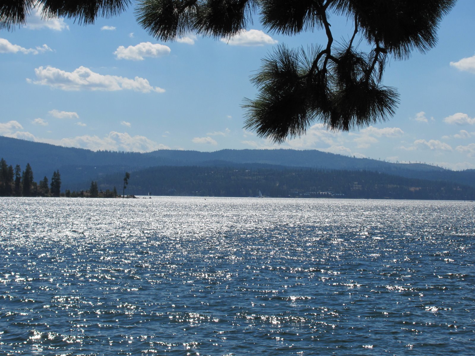
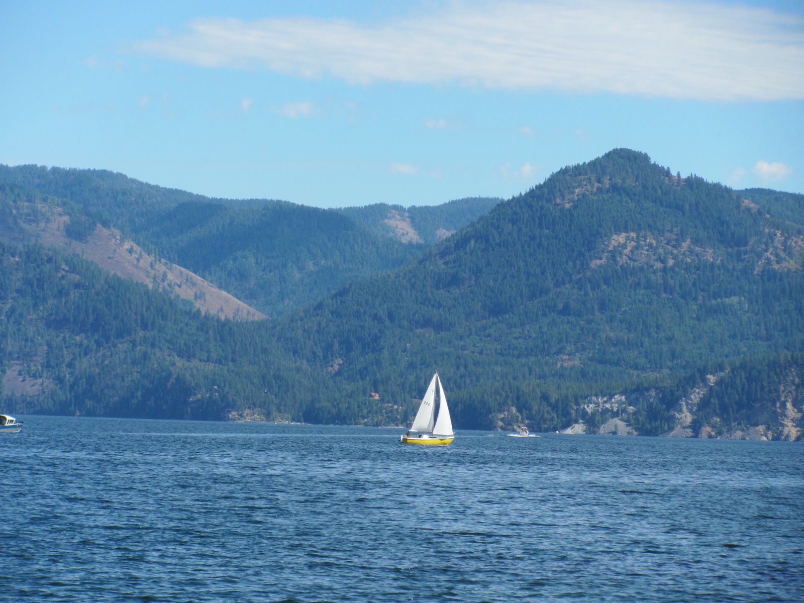
It was a beautiful day on Saturday, September 4th so we first went to the farmers market in Hayden Lakes. (lots of crafts and produce!)

We then headed to Post Falls.
The Spokane River is the outflow for Lake Coeur d'Alene in the Idaho Panhandle, draining from the northwest corner of the lake near the city of Coeur d'Alene.
Although Lake Coeur d'Alene was glacially formed, the surface level of the lake is raised about seven feet during the summer months by the Post Falls dam. The dam at Post Falls is also capable of lowering Lake Coeur d'Alene by as much as 12 feet.
The Spokane flows west approximately 25 miles into east central Washington state through the suburban Spokane Valley to Spokane City. The Spokane River is one of the most polluted river in the U.S. The EPA is trying to clean up the river at the Coeur d'Alene basin.
After leaving Post Falls we drove over to the city of Coeur d'Alene and along the shore line. The sky was a beautiful blue although there were strong winds creating white caps on the lake.

From here we are heading to Montana for few days. We had planned on heading up to Canada, however upon checking the weather (37* and rain) we decided to put off that trip to another time.

Hope all is well with everyone, more on our adventures later.

Until then, we love to hear from you also,

Candy and Johnny


Posted by Picasa

Coeur d'Alene, Idaho

On September 1,we said our fond farewells to Anacortes and our friends to once again head eastward! We had a great time in Anacortes but it is time we
head back home (although we will not get there for another two months!)

Our plan was to stay overnight at the Casino at Snoqualmie, Wa. Some of our friends like to stay in casino's parking lots for a night and then continue their travels, so we decided to try a stay at a casino. When we pulled into the parking lot the casino was lovely, new, as it had only been open for a very short time. Unfortunately the parking lot was not as flat as we need to have for our refrigerator to work. So we left as spent the night in a small RV park in Ellensburg, Washington.

Our next destination was Coeur d'Alene, Idaho.

Thr RV park that we stayed at was on Blackwell Island, along the Spokane River. What a lovely setting! The weather is perfect! Warm and sunny. We decided to tour the area. Our first stop was to drive around Hayden Lake. It was supposed to be a very pretty drive. It was but all we could see were the trees, there were very few spots to pull off to view the beautiful lake.

From Hayden lake we headed north to Bayview, along Lake Pend Oreille. We discovered that Lake Pend Oreille was glacially formed during the ice age. It is also believed that the eastern side of the lake was in the path of the ancient Missoula flood. The dam for the Missoula flood is believed to have existed just east of the lake along the Clark Fork River, between the Cabinet and the Bitteroot mountains.

The area around the Lake is the traditional home of the Kalispell Native American Nation. A French fur trapper who entered the region in the 1800's is believed to have given the lake its name. The words "Pend Oreille" are French for and ear-hanging or pendant. Ear pendants were characteristic of the Kalispell Tribe. The lake is shaped much like a human ear when viewed from above or on a map.

During World War II, the south end of the lake was the second largest navel training ground in the world. Built as a result of the Japanese attack on Pearl Harbor, the training station is now Farragut State Park. (Faragut State Park is the second largest State Park located in Idaho.) The lake is still used by the Navy's Acoustic Research Detachment to test large scale submarine prototypes: the significant depth of the lake gives acoustic properties similar to the open ocean.

It was a beautiful setting and we stayed for lunch on the floating dock restaurant.
Tomorrow we are off to the Farmers Market and Post Fall.....

More later,
Until then,

Candy and Johnny

Posted by Picasa

Whale Watching - 1


It was a beautiful Friday evening as we set sail on the Whales-watching ship, the Island Explorer. As we motored past several of the San Juan Islands a Bald eagle was spotted along the shore. Quite an impressive sight! On the way out to the watching area we encountered a harbor seal playing in the surf. We finally found some whales.
We were told that the whales that were feeding in the area were "Minke" whales.

Minke whales are part of the rorquals, a family that includes the humpback whale, the fin whale and the Blue whale.

The Minke Whales are the second smallest baleen whale - only the pygmy right whale is smaller. Upon reaching maturity (6-8 years) males measure an average of 23 feet in length and females about 24 feet in length.

The Minke whale is a black/grey color on the top and white on the bottom. Common minke whales (northern hemisphere variety) are distinguished from other whales by a white band on each flipper. Minke whales typically live for 30-50 years.
Due to their relative abundance minke whales are often the focus of whale-watching cruises. Minke whales are frequently inquisitive and engage in "human-watching". Minkes do not raise their flukes out of the water when diving and are less likely to breach (jump clear of the sea surface). This combined with the fact that minkes can stay submerged for as long as 20 minutes (or possibly their bad breath) has lead some whale watchers to label them 'stinky minkes'.

In 2010, a minke whale swam for 2 hours with Jody Nelson who was stand-up paddle surfing from Santa Catalina Island to Dana Point in Southern Calif. The whale swam close to her, rolled around repeatedly alongside her, and blew bubbles beneath her board.

We had hoped to see some Orca whales that had been the area, however they must have moved out to deeper water. As the sun was setting in the west we headed back to shore.

To see those photo's, please see the next blog page.

Our time here in Anacortes is coming to an end and we will begin our trip back toward Florida soon.

That is all for now,

Candy and Johnny

Whale Watching - 2


We had a great time on the whale-watching tour! As we headed back to the dock, Mt. Baker was visible off in the distance. The sun setting in the west was so beautiful! The sky went from yellow to a wonderful pink!
Another great day in the life of an RVer.

Love to all for now,
Candy and Johnny

Posted by Picasa