Friday, September 30, 2011
Sept 9, 2011 Kootenay National Park
Located in British Columbia, south of Yoho, 543.7 square mile Kootenay National Park encompasses two river valleys, the Kootenay and Vermilion, amidst a stunning environment of the west side of the Rocky Mountains.
The word 'Kootenay' is the name the local natives applied to themselves and means 'river people.'
The crest of Vermilion Pass (5380 feet) marks the continental divide and the boundary between Banff National Park, Alberta, and Kootenay National Park, BC. From the pass, waters flow east to Hudson's Bay and the Atlantic Ocean via Bow, Saskatchewan, and Nelson river systems; and west to the Pacific Ocean via the Vermilion, Kootenay, and Columbia rivers.
In terms of its recent forest fire history, Vermilion Pass is an oddity in the Canadian Rockies. Much of it has burned twice in just 35 years. The first fire was started on July 8, 1968, by July 18 the fire was finally out with the help of many firefighers. The summer of 2003 was a scorcher in western Canada - the third driest in the
in the Rockies on a record that goes back more than
a century. That summer saw more forest fires in the
Rocky Mountain National Parks than in any other
year since 1936. The two fires, fulled by some areas of forest that hadn't burned in 500 years, and fanned by high winds and high temperatures combines to burn 12.6 percent if the park's area.
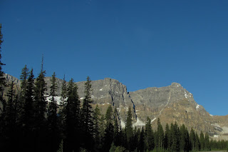
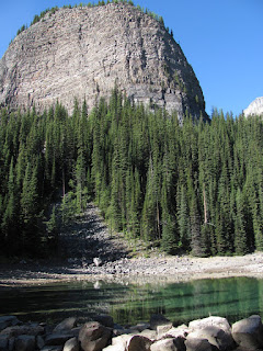
At Marble Canyon (photo's right) 4 miles west of the continental divide, the glacially-fed waters of Tokumn Creek are eroding through the lip of a hanging valley to create a spectacular canyon in the dolomite bedrock. From the photo's you can see the area that was burned in 2003. There is a quarter of a mile pathway that criss-crosses the narrow gorge on bridges, providing excellent viewpoints of the canyon
As we followed the Kootenay Parkway southeast along the Vermilion River, we came upon another short walk to Numa Falls. Here the brilliantly turquoise Vermilion River has carved a picturesque limestone canyon.
The turquoise color of the water here if fantastic! Each park was so beautiful and each had so many different vistas to view, I almost hate to leave this area as there still is so much to see... however, all good things must come to an end! Tomorrow we pack up and head back to the States. I hope that we will be able to return to this area again in the near future. What a beautiful place!!!!
Tomorrow we head for Great Falls, Montana. More from there..
Candy and Johnny
Sept 8, Banff - Day off
As we have been on the go since our arrival in Canada we decided to take the day off and stay in Banff for the day.
We decided to hike along the upper bank of the Bow River. From here we had a nice view of the Bow Falls and the Banff Springs Hotel located along the bank above the falls.
.
Construction of the Banff Springs Hotel began in late 1886. In the summer of 1887, CPR General Manager, William Cornelius Van Horne visited the construction site and was shocked to see the building being constructed backwards. The kitchen overlooked the rivers, and the guest rooms faced the forest. He hastily sketched additions to correct the matter. Amid much national interest, the $250,000 250-room hotel, complete with sulphur water piped from the Upper Hot Springs, opened on June 1, 1888. It was the hotel in the world at the time. Room rates started at $3.50 a day.
We walked around town and found an internet cafe so that we could check our e-mail and catch up with the rest of the world. With no phones and no internet
we were out of the loop. It was good to be back in touch with everyone.
We headed back to our RV camp and it was like we had our own personal campground. After the holiday weekend, we had the place to ourselves. The mountain view from the campground was again spectacular!!
At the edge of town we drove to the Vermilion Lakes, an extensive region of montane wetlands. Their name comes from ochre beds at the iron-rich mineral springs at the Vermilion River pass where the Black-foot and Kootenay tribes obtained materials for some of their ceremonial body paints. The lakes are quite shallow and the surrounding region has begun to fill in with aquatic vegetation.
At 9673 feet, Mount Rundle stands proudly behind the Vermilion Lakes. What a beautiful sight to see the mount reflected in the Vermilion Lake.
Tomorrow we plan to visit the last of the National Parks here in the Banff area. Kootenay National Park.
Until then,
Candy and Johnny in Canada
Wednesday, September 28, 2011
Sept. 7, 2011 The Icefield Highway
Just as the sun was peaking over the mountain tops we
headed north to the Ice fields highway. This road is considered by many to be the most spectacular drive in the planet. The Ice fields Parkway follows the Bow, Mistaya, North Saskatchewan, Sunwapta and Athabasca valleys. Twelve ice fields flank the road, five of them can be seen of a fair day. The road passes through remote, high elevation terrain, and the scenery takes your breath away at every turn.
A Canadian National Park pass is required.
Our first sight was this bear as he ran across the road in front of us. We had seen several other bears and on the Park Radio station, they report sightings of bears in the area. If a bear has been seen in the area there is a "Group of Four Hiking" rule. It is felt that a
"tight" group of four is less likely to surprise a bear, or be attacked by a bear than an individual hiker. There were many trails that we had seen the Hike with Four sighs. This guy ran across the road and into the bushes......
The scenery along the road was beautiful in every direction! We came upon the Crowfoot Glacier. A century ago, when this glacier was named, three "toes" of ice clung to the mountainside. Since then, the lower toe has melted and the middle toe is also disappearing. A glacial retreats go, that of the Crowfoot Glacier has been dramatic. Photographs take in the early 20th century showed ice extending to the moraines at the base of the mountain.
The last photo is of the Weeping Wall.
In the upper reach of the North Saskatchewan Valley, tremendous limestone cliffs sweep 1968 feet skyward, blocking the sun until midmorning. These cliffs support many waterfalls - the product of melting snow. The greatest concentration is at the Weeping Wall. The cascades are most prolific on hot days in late spring and early summer. In winter, pillars and curtains of ice drape te Weeping Wall, creating a playground for waterfall ice climbing.
From this point we have reached the Columbia Icefield.... more on that below.
Candy and Johnny
Sept. 7 Columbia Ice-Fields
With an area of 83 sq.mi., the Columbia Ice-Field is by far the largest ice-field in the
Canadian Rockies, and the most accessible. The Columbia's Ice Field provides a window on the Earth's icy past.
What is an Ice-Field?
An Ice-Field is a body of ice from which glaciers flow in more than one direction. Meltwaters from the Columbia Ice-field feed three of Canada's principal river systems, and three oceans: the Pacific Ocean via the Columbia River; the Artic Ocean via the Athabasca River, Slave River, and the Mackenzie River; and the Atlantic Ocean via the North Saskatchewan River, and Hudson Bay. The summit Snow Dome on the Columbia Ice-field is the apex of this tri-oceanic watershed - the only one in North America.
The Athabasca Glacier (photos here) is the best know glacier that flows from the Columbia Ice-field. From the ice-field rim (on skyline) to its terminus or ending point, the Athabasca Glacier descends 2689 feet in 3.84 miles. The surface of the glacier is moving faster and is under less pressure then the ice beneath. So the surface ice accelerates over the cliff and becomes heavily fissured. These cracks are called crevasses. There are more than 30,000 crevasses on the Athabasca Glacier.
The Athabasca Glacier occupies a U-shaped valley, scoured when the glacier was larger. Because of the U-shape, the glacier is deeper along its mid line than at
its sides. The deepest point is 1049 feet.
In 1890 the glacier reached over the point where the road and the information center is located today.
Have to admit that walking right up to the edge of a glacier was pretty impressive! It is also startling to realize how much the glacier is receding.
From the photos it is difficult to see just how huge the glacier actually is, if you look closely you can see that those are cars parked by the trail leading to the toe of the glacier.
From here we continued north along the ice-field.
See below,
Candy and Johnny
Sept 7, to Athabasca Falls
As we continued our journey, we are headed to Athabasca Falls. Along the way we came upon the "Endless Chain Ridge". (top photo) Although not endless, the ridge is a prominent feature for some 12.4 miles along the Ice-fields Parkway north of Poboktan Creek. To explorers traveling at a horse's pace, it would have been in view for several days.
Our next stop was Athabasca Falls. Whereas many waterfalls in the Rockies plummet from hanging valleys, the 75 foot high cascade of Athabasca Falls exists for a different reason. Here, the ancestral Athabasca Glacier encountered a resistant outcrop of Gog Formation quartzite.
The Athabasca River carries the greatest amount of
water of any river in the Rocky Mountain parks.
And our journey continues north to Jasper....
Candy and Johnny
Sept 7 Jasper and Maligne Lake
Our next view was of Mt. Edith Cavell. Mt. Edith Cavell at 11027 feet is the highest mountain near Jasper. First Peoples knew it as the "White Ghost", probably because of the snow-covered mountain's appearance in the moonlight. At no other location in the Rockies do you drive so directly toward such an impressive mountain.
We finally reached Jasper and headed to the east to Medicine Lake and then on to Maligne Lake. I wish that we could have stopped at Maligne Canyon but we were running out of time.
We came upon Medicine Lake, located between Maligne Canyon and Maligne Lake in Jasper National Park. It is curious water feature because it has no surface outlets, but its water level fluctuates significantly over the course of a few months. The Maligne River, swollen in spring and summer with glacial run-off, feeds the lake so that the lake looks quite charming. By autumn, the lake drains almost to the point of becoming a huge mud puddle. Locals call it "the leaky bathtub." Where does the water go? It drains downwards at the rate of 57 cubic meters per second into channels and caves carved out of the water-soluble limestone underneath the lake.
As we continued toward Maligne Lake we encountered a ranger in the road. She stopped us and asked if we wanted to see some bears???? It seems that there was a mother bear and she had three cubs with her. Three cubs are very unusual for a bear. They figured that the cubs had been born sometime in February. We were told that we could pull up and stay for about three minutes to take photos, before they would make us move along. What a nice surprise to see!!!
We then continued on to Maligne Lake. As we were both tired we did not hike around the lake or take the boat trip. We will have to save this for another trip.
Lake Maligne is by far the largest natural lake in the Canadian Rockies. Fed by meltwaters from the Brazeau Ice-field and other glaciers at its south end. The lake is 13.64 miles long with a maximum depth of 318 feet. Its waters are dammed by the second largest rockslide in the Rockies.
We had thought of staying overnight in Jasper but decided that we had been on the go so much the past several days that we headed back to Banff. On our way home we found some mountain goats having dinner along the road. Momma and baby!!
It was a long and beautiful day!!!! I am sure that there was more to see and do, that we will save for another time.....
Until Later,
Candy and Johnny
Sunday, September 25, 2011
Lake Louise to Lake Agnes
Tuesday, September 6. We can not believe our good weather but it
is once again a beautiful day. Our objective today is to head to Lake Louise and surrounding area. Lake Louise is about 34 miles northwest of the town of Banff, and is one of Canada's most famous natural attractions. The deep green lake, surrounded by mountains and glaciers, has drawn visitors for over a century. They have marvelled at the natural beauty and have wondered why the lake is such a strong, almost shocking green color. It comes from sunlight hitting the lake's floating mineral deposits of 'rock flour' which come suspended in the melt waters from Victoria Glacier
Lake Louise is the daughter of Victoria Glacier. (third photo down for an up close view of the glacier) In the distance past, the glacier covered the whole lake. It gradually deposited debris form a landscape feature called a 'terminal moraine' which acted as a dam to hold the melt water as the glacier slowly retreated. Today the lake, created by the moraine, sits at an elevation of 5,680 feet, slightly more than a mile above sea level. It is about 1.5 miles long, 295 feet deep.
Native peoples called it 'the Lake of Little Fishes'. Its modern name honors Princess Louise Caroline Alberta, fourth daughter of Queen Victoria
We headed off on a "little" hike to see Mirror Lake and maybe continue to Lake Agnes. The hike to Lake Agnes is one of the most popular trails in the Rockies. The trail branches from the lake shore just beyond the Fairmont Chateau Lake Louise and begins its ascent through a damp lower subalpine forest. At the first switchback we could see Lake Louise directly below. At this point we had hiked 1 mile and were about half way to Lake Agnes. A short climb later we reached Mirror Lake. Above Mirror Lake you can see Beehive Mt. It had been quite a climb but as we had come this far we headed up to the teahouse and Lake Agnes. The teahouse is located above Bridal Veil Falls on the shore of Lake Agnes. I was feeling quite tired, and I discovered why.... since leaving the Chateau below we had climbed a height of 1,279 feet and 2.1 miles, or roughly the equivalent to 130 flights of stairs!!!!!!!
We stopped at the teahouse for something to eat and drink. The original teahouse was built by the CPR in 1901. Built of vertical logs, the original tea house was replaced in 1981 with a new log building that includes original windows, tables and chairs. The lake was named
after Lady Agnes Macdonald, wife of Canada's first prime minister, Sir John A. Macdonald. The teahouse is open for lunch and tea in the summer months. The gentleman that served us told us that he lives up there for the summer. I could not imagine making that hike every day. Supplies are brought up by horse pack.
Now, all I had to do was to make my way back down the hill... not as easy as it sounds.
Have to admit that I was pretty tired when we finally returned to Lake Louise. I was very happy to be off the trail.
From here we stopped along the Bow Valley Parkway and Johnston Falls.... see below....
Candy and Johnny
Subscribe to:
Posts (Atom)